

A Distorted View of the World: Cartography and the Invention of Western Centrality
By Natalie McCarty
Everything is political, and that includes the map of the world they teach you in school or plastered on globes at Home Goods.
You don’t learn about the real world, you just inherit a version of it, and that version–in the case of the United States–is oppressive, racist, calculated, and one-thousand percent invented to keep the Western world at the center.
Sourced Through Pinterest
The world map most people grow up with is treated as a finished image, something to be memorized rather than questioned. What it doesn’t say is that it is built on distortion, and it is not random or inconsequential: It reflects a system of power embedded into how the world is shown and therefore understood.
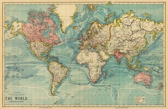
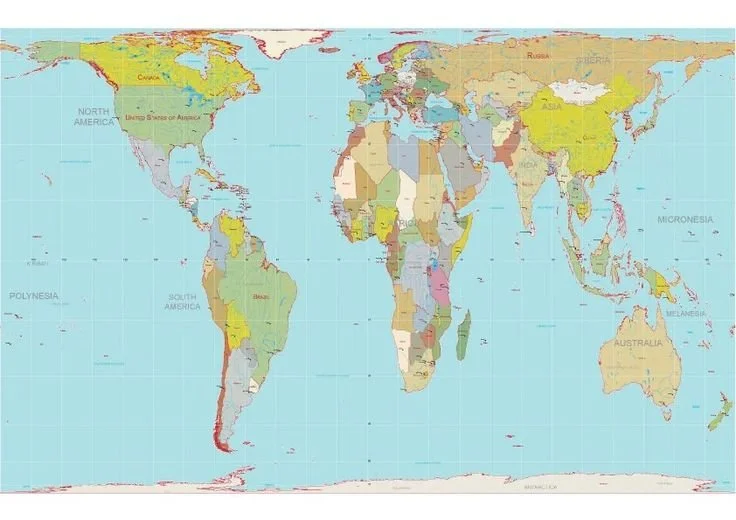
The standard map, typically based on the Mercator projection, was never designed to represent the global scale accurately. It preserves navigational angles, but in doing so, it enlarges regions farther from the equator and compresses those closer to it. The result produces a consistent visual hierarchy.
Sourced Through Pinterest
The most obvious example is Africa.
Africa is enormous; in fact, it's so large that the United States, China, India, and much of Europe could fit inside it; however, on the map most people grew up with, it doesn’t read that way, of course. It’s significantly reduced and visually contained to make it feel much smaller than it is. To make it feel manageable, secondary.
Meanwhile, Greenland appears dramatically oversized, occupying visual weight that does not correspond to geographic reality. Africa is roughly fourteen times larger, yet the map does not communicate that proportion.
This also communicates something else: a reordered sense of scale and importance.
That matters because when you consistently shrink a continent that is overwhelmingly not-white and expand regions that are historically white and Western, you are reinforcing a hierarchy.
What begins as visual distortion becomes perceived logic and gets absorbed early—before there’s language to critique it, before there’s context to challenge it.
By the time you’re old enough to question it, the visual logic has already settled in: what looks bigger feels more important. What sits at the center feels like the reference point for everything else.
And the United States understands the value of that positioning.
On most standard maps, the U.S. appearance of largeness enforces this idea that the nation is central, stable, and dominant. This is how power sustains itself visually.
Cartography, in that sense, has never been separate from politics. In fact, it has been one of its quieter tools.
The same logic shows up in the borders we take for granted. Lines that look precise and authoritative on paper often trace back to moments like the Berlin Conference, where European powers divided African land with no regard for the people living on it.
Those borders were drawn to control territory, people, and narrative.
And once they were drawn, they stuck. They became countries, conflicts, and identities that got folded back into the map, as if they were natural outcomes instead of imposed structures.
So the map does two things at once: it distorts scale, and it legitimizes the results of that distortion. It makes certain places look smaller, then treats their instability as inherent. It centers certain nations, then frames their dominance as deserved.
It’s a closed loop, and it’s an effective one.
There are alternative projections—like the Gall-Peters projection—that attempt to correct the imbalance and give landmasses their actual proportional weight. But they tend to feel unfamiliar, even uncomfortable, to people seeing them for the first time.
That discomfort is telling because it reveals how deeply the original distortion of the view of the world has been normalized.
Sourced Through Pinterest
The map is one of the earliest ways we’re taught to see the countries, and one of the earliest ways that hierarchy is introduced under the guise of objectivity. It shrinks what has been historically exploited and enlarges what has historically held power.
You don’t question it because you’re not taught to. But once you do, it becomes difficult to unsee: what looks like neutrality is often just repetition aligned with power.
You must fight the oppression by engaging in education. This is how the system is made visible. And once it is visible, it stops being absolute.
We must refuse the version of the world that was handed to us as fact and instead inquire as to why that is.